Since releasing the first version of TransLoc Traveler in November, we’ve been hard at work making improvements and now we’re ready to introduce a couple new features we think you’ll love.

Route Usage
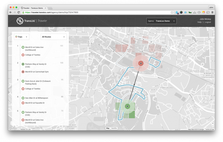
First up – route usage. When you drill down to view a specific trip, Traveler will now show you all of the routes used by riders to go from the selected boarding stop to the selected alighting stop. The routes are colored based on how heavily they are used. Hovering over a route will display a tooltip that shows the route name and how many riders used that route.
With this new feature, you can now determine how different routes are utilized by riders when multiple route options exist. It’s also a useful visual indicator by simply highlighting the paths that the routes take to understand how direct the current service is for the trip.

Travels
The second new feature is a big one—we call it “travels.” Travels shows you how people move around your city – regardless of their mode of transportation, whether it be walking, biking, bus, car, etc.
With this feature, you can select a region of interest on the map. The map then displays where people go to or come from in relation to the selected area. You can explore any area in the general vicinity of your agency.
The idea is that you can now see exactly where people go and where they come from, giving you the ability to definitively gauge travel demand. Travels also gives you the ability to understand how your current service aligns with people’s actual travel patterns.